Editor’s Note: The Qinghai-Tibet Plateau, in south-western China, is known as the “roof of the world”. It is home to more mountain glaciers than anywhere else on the planet and is the source of some of Asia’s most important rivers. It also plays an important role in, and is vulnerable to, climate change. In April this year, China passed a law to conserve the ecology of the plateau, which will come into effect on 1 September and calls for increased research.
The first step is to visit the region. Geologist Yang Yong has been carrying out field studies on the plateau since the 1980s, and visited once more this May and June, during which he sent us notes and observations from his travels, including from expeditions undertaken last year. Yang’s accounts offer a first-hand look at the effects of climate change on the plateau.
In May this year, I followed the Hengduan mountains into the south-east of Tibet. Now, in June, I’m passing through the lakes of central Changtang, in northern Tibet, heading along National Highway 219 towards the Taklamakan Desert in Xinjiang.
I’ve visited the Qinghai-Tibet Plateau almost annually for over 30 years. I’ve seen the impacts of climate change with my own eyes, and witnessed the environmental and ecological changes that have occurred in a region often known as “The Third Pole” or “Asia’s Water Tower”. We are also very likely to see the effects of an El Niño climate pattern over the next few years, possibly leading to temperature spikes. I am extremely worried about the challenges this will bring for the climate, hydrology and people of the plateau.
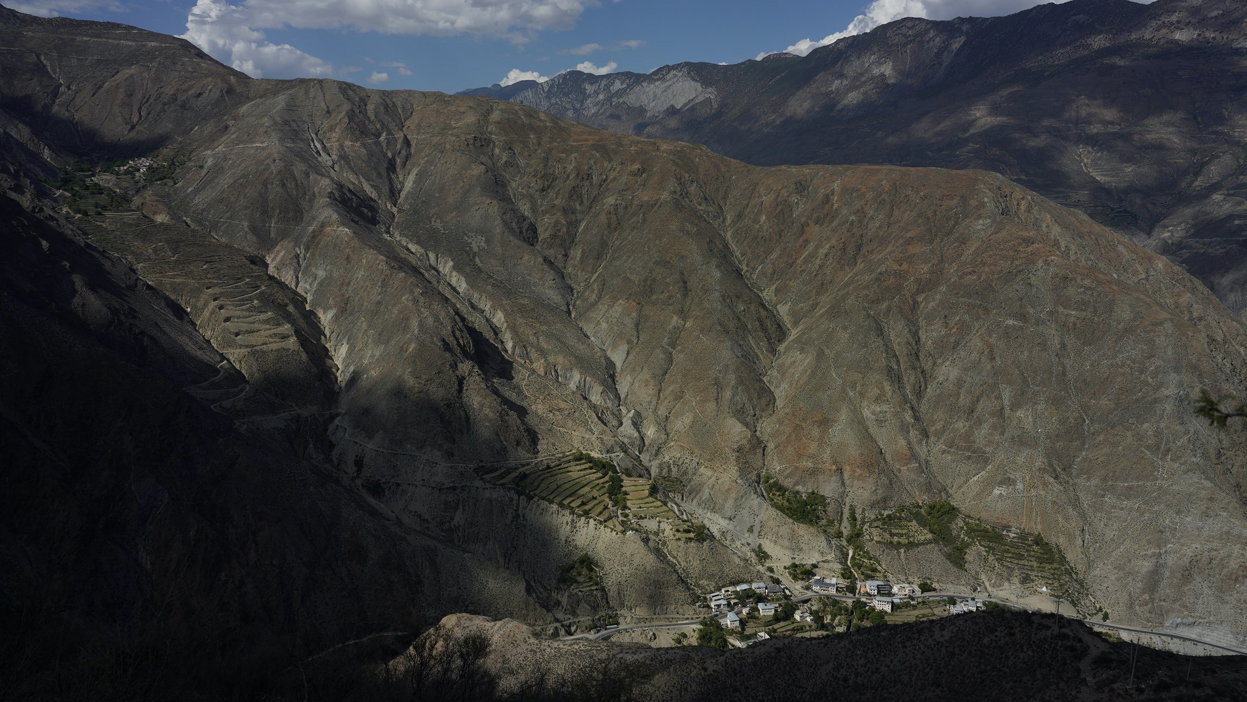
My previous visit there was in 2022. I set out in April, from the scenic mountain town of Bingzhongluo, passing along rocky, cliff-hugging roads before entering Tibet at Zayu. This area is home to several temperate glaciers, of which I saw the Sapu, Qiaqing, Zepu and Renlongba. In July, we followed the Himalayas west, studying the sky-blue waters of the Yangzhuoyong Lake and Shiquan River, among others, along the way. After visiting the provincial capital, Lhasa, we crossed the Tanggula Mountains into the Sanjiangyuan (Three River Source) national park, continuing over the Kunlun and A’erjin mountain ranges to the arid Qaidam Basin. In early August, we returned to Sichuan. During this trip, we studied deserts, seasonal rivers and salt lakes. We discovered two new areas of yardangs, wind-eroded formations of bedrock that are found across the basin.
That trip was to study the temperate and subcontinental glaciers of Tibet. We chose to travel between April and July, as April is avalanche season in south-east Tibet, while in July the whole region has entered the flood season. Observing the plateau during different hydrological conditions allows for a fuller understanding. The sustained high temperatures and drought seen in 2022 mean that this year may be an unusual one for hydrology, as I embark on my latest trip to the plateau.
Heat
It might be hard to imagine, but what has struck me most while studying the glaciers during my recent expeditions is the heat. It should have been the rainy season as we crossed northern Tibet last July. But the sun blazed every day and the ground was parched.
It was as if I wasn’t at high altitude, but in an inland summer. I remember needing a jacket at this time of year during the 1980s, sometimes even cold-weather gear. But in more recent years it has been warm enough for shorts and t-shirts. The temperature falls during rain or windy periods. Otherwise, the air only cools in the evenings.
Surface temperatures on the wetlands, grasslands and the now-desertifying sandy soil surrounding the glaciers are reaching over 30C, even 40C.
That is the new normal on the plateau. One mid-August a few years ago, we recorded a temperature of 46C from a surface monitoring station to the west of Geladaindong Peak in the Tanggula Mountains. In January 2021, I was at the Jianggudiru glacier, at the source of the Yangtze. It still hadn’t snowed that season and our cold-weather gear remained unused. Under the blazing sun, water ran through the cracks in the glacier’s surface.
We measured temperatures of over 10C at the glacier’s surface, and above zero within the ice. This was shocking. A glacier in an oven-like environment is extremely vulnerable and will soon melt and collapse.
Glaciers
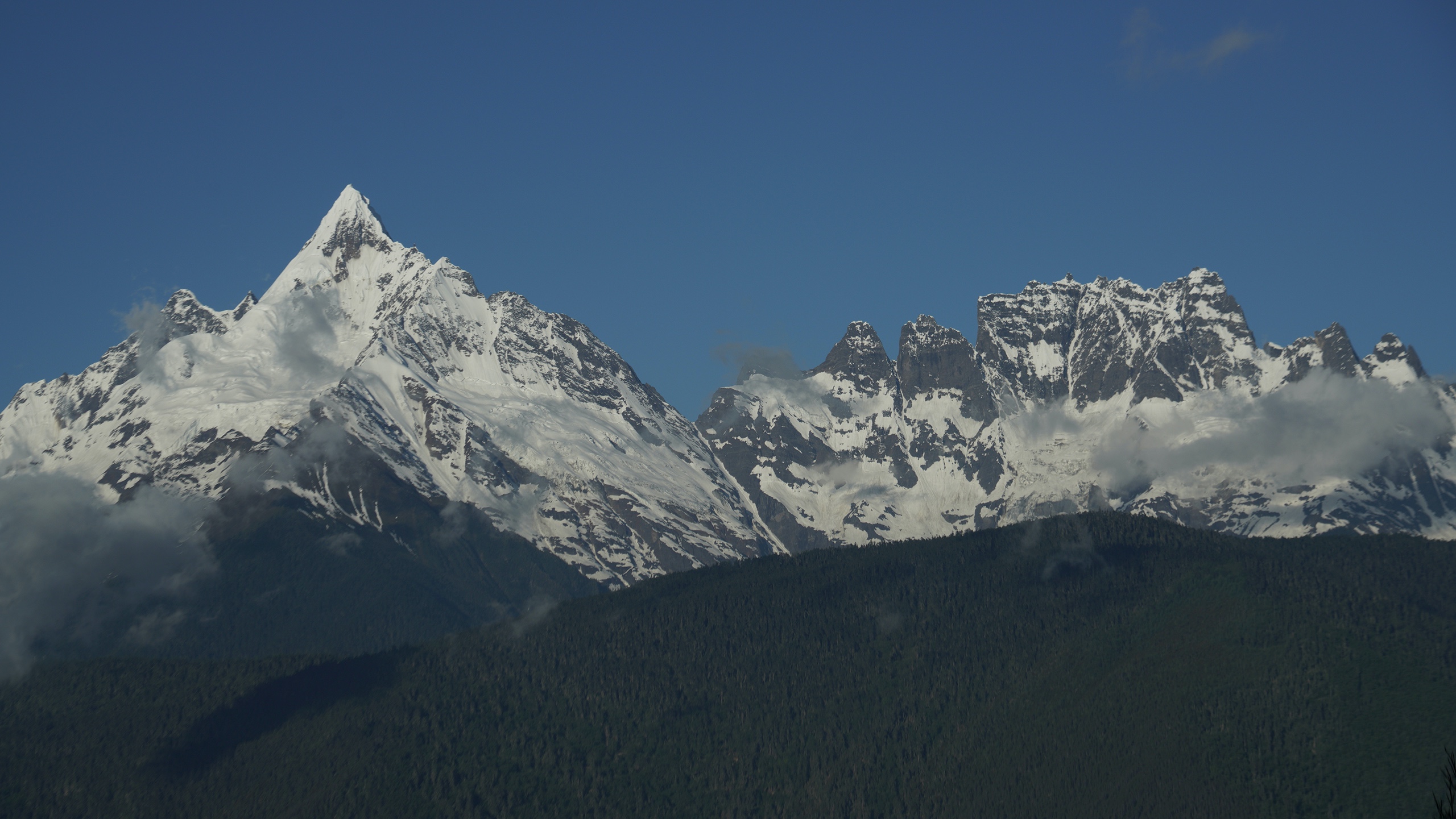
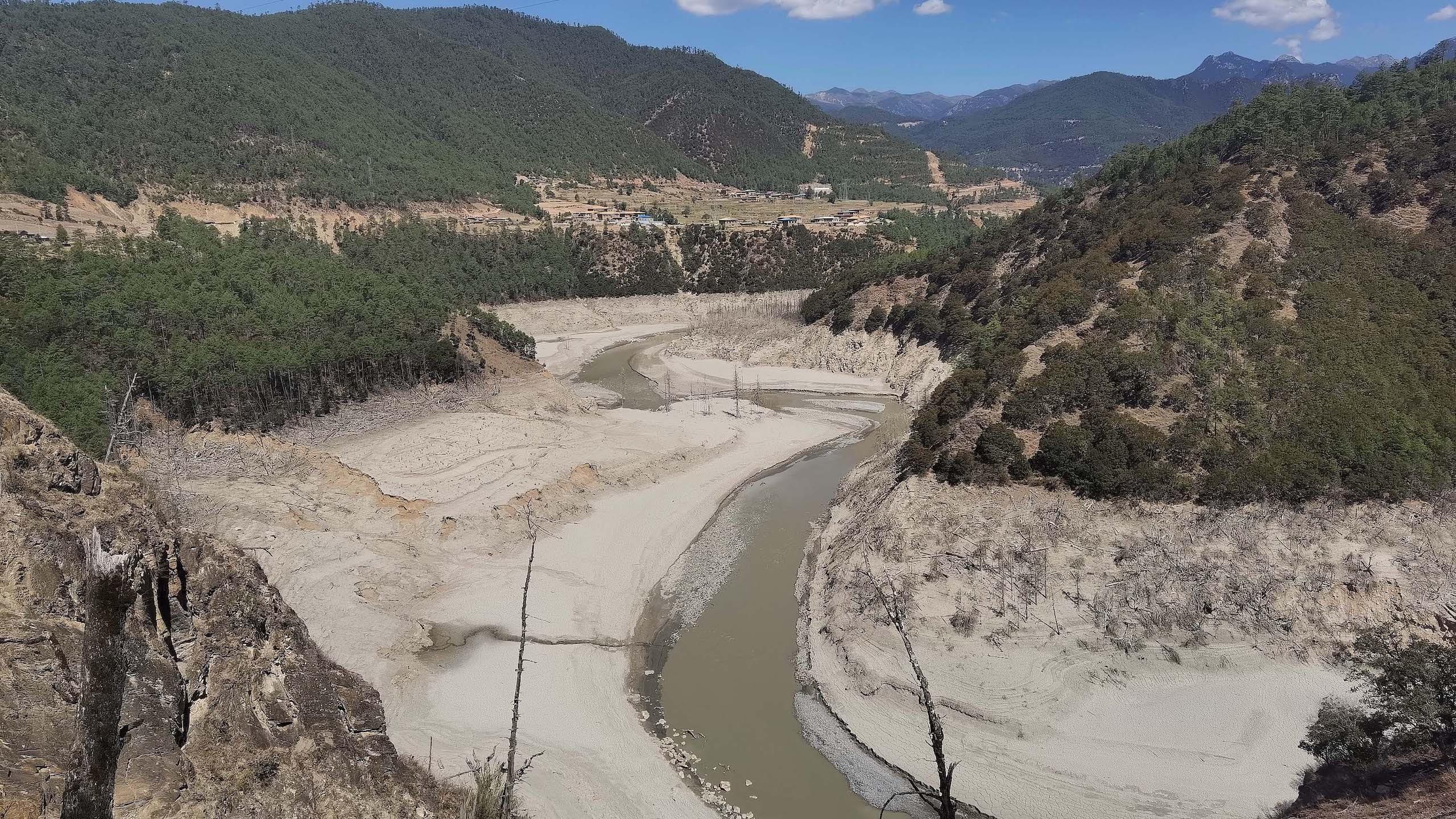
I have recorded the changes in many glaciers over my 30 and more years of visits to the Qinghai-Tibet Plateau. The snow above temperate glaciers often melts, causing flooding. That leaves stones, mud and sediment lying on and around the glacier, as well as the physical damage of the flood. Those signs allow us to monitor the shrinking of the glacier.
A glacier in an oven-like environment is extremely vulnerable and will soon melt and collapse
Several glaciers at the source of the Yangtze have shrunk significantly between the 1980s and today. For example, comparison of field study findings and satellite images across time shows that the Gangjiaquba glacier has retreated by over 2,000 metres in the last half-century, and the Jianggudiru north glacier by over 500 metres.
The Jiemayangzong glacier, in the west of the Himalayas, is the source of the Yarlung Tsangpo River (which becomes the Brahmaputra). I have seen how its once-steep face has shattered, becoming a slope of ice leading down to a glacial lake. It has retreated 400 metres over the last 12 years.
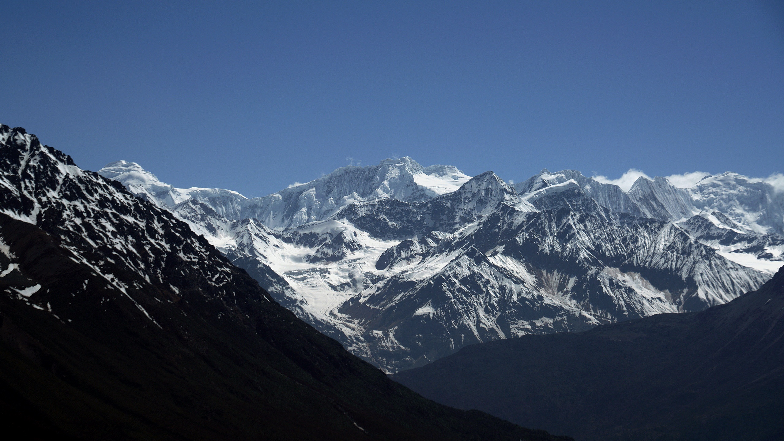
I could even hear running water and moving stones under the glacier. The ice pinnacles and peaks I once saw protruding above it are now as good as gone, indicating that it has melted quickly in recent years. The riverbed in front of the glacier has widened and the glacial sediment washed flat, rarely piling up into hillocks now. Upstream on the Tuotuo River, along the 20-plus kilometres of the headwaters at Naqinqu, and along the glacial tributaries on either side, as well as on both banks of the Sumei riverbed, you can see large moraines and glacial till. At the Renlongba and Animaqing glaciers, we encountered flooding caused by glacial collapse.
China has carried out two surveys of its glaciers, recording their position, height, area and volume, and compiling these into book form. That data shows that between the mid-1950s and around 2014, China’s glaciers shrunk by 18% in terms of area. Shrinkage was fastest in the east of the Kailash range in the south of the plateau, in the southern Himalayas, and around the source of the Indus River in the western Himalayas, where average annual shrinkage was 2.2%.
And that’s just what can be seen from the surface. The Himalayas are dotted with tens of thousands of glacial lakes. As the glaciers melt and retreat, those lakes get bigger, and the ice they cover degrades. Research published this year has found that 41.3 billion tonnes of underwater glacial ice was lost between 2000 and 2020 – 2.7 billion tonnes more than had previously been estimated.
Water
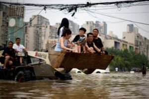
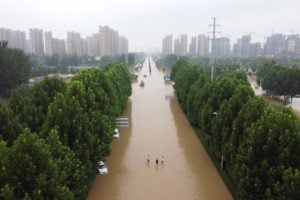
July and August are the flood season. There should be plenty of water. But on our recent trips during these months, we saw little rain. Rivers were very low compared with a normal year, with parts of the riverbeds exposed. Reservoirs were also low.
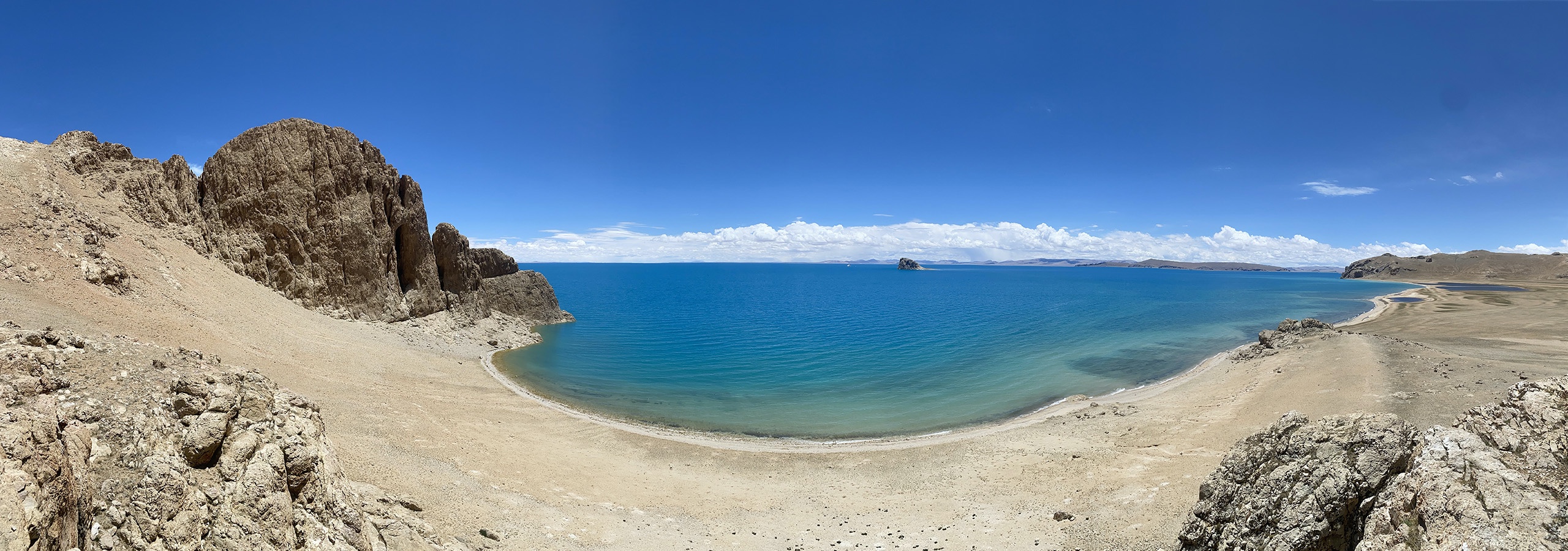
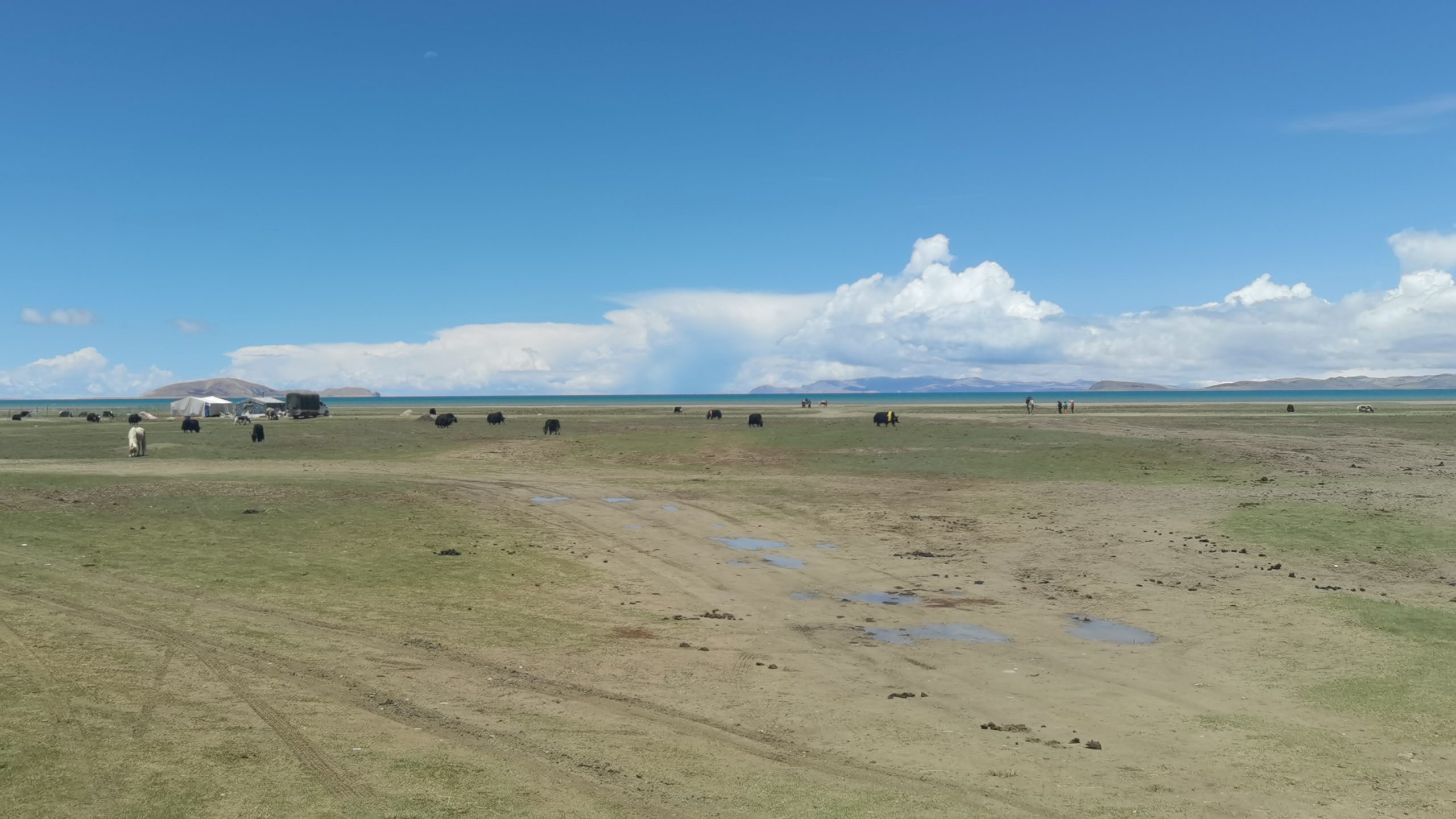
This could be due to a lack of precipitation in a hot dry year, or a localised phenomenon. Glacial melting and retreat would normally be expected to lead to more water in lakes, and I did see this in the Sanjiangyuan region. In some places, there were more aquatic plants than previously noted. Over the last 50 years, the number of lakes of one square kilometre or more in size on the plateau has risen from 1,081 to 1,236, with total area increasing from 40,000 square kilometres to almost 50,000.
A lot of this extra water comes from melting glaciers, but the melting of permafrost – ground frozen year-round – is also a factor. Research has projected that permafrost on the plateau will shrink 39% by mid-century (2030–2050) and 81% by the end of the century (2080-2100), compared to 1980–2000. It is hard to imagine what the plateau will look like without permafrost.
The increase in the number and size of lakes is not good news. My own observations indicate it is the result of changes in river systems and natural disasters. On an earlier trip in 2000, I saw the flood caused on the Yarlung Tsangpo when a landslide dam on one of its tributaries collapsed. Elsewhere, in 2012, the Zhuonai Lake rose and broke its banks, creating a new river. This changed the river system at the source of the Yangtze, with a new lake almost encroaching on the Qinghai-Tibet railway.
A survey of the Qinghai-Tibet Plateau that started in 2017 found melting had accelerated between 1980 and 2018, with the amount of liquid water increasing. In general, the amount of water in rivers on the north of the plateau, which do not reach the ocean, increased, while that in some rivers in the south tended to decrease. Scientists say climate change has “unbalanced” the hydrology of the plateau and that this may cause water conflicts to worsen.
While it may seem there is more water in the rivers and lakes, the water cycle has been damaged, and this may reduce water availability. A 2022 paper found that terrestrial water storage on the plateau fell by 10 billion tonnes a year from 2002 to 2017, with net loss since the beginning of the century projected to reach 230 billion tonnes by 2060 – severely threatening the region’s ability to provide water.
Grassland degradation and desertification
In the Rebujiecuo basin, 10 kilometres from the Jiemayangzong glacier, we saw the terminal moraine ridges left by glaciers during the Little Ice Age of the early 15th to the early 20th century. These are piles of debris which accumulate when the end of a glacier remains in one place for a period of time. Flood debris covered dozens of square kilometres of the basin. Today, the basin looks more like an arid desert.
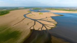
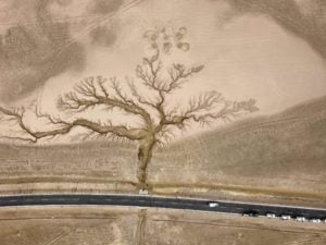
Previously, areas such as the Changtang and Kekexili were covered with vegetation and greenery as far as the eye could see. More recently, these areas have started to look like deserts. At the source of the Yangtze and even upstream on the Tiantong, Yellow and Yarlung Tsangpo rivers, and in the heart of Kekexili, sand dunes are getting taller and merging to form expanses of desert.
For the last 20 years or so, human activity on the Changtang and in Kekexili has been expanding, with livestock now grazing higher than 5,500 metres. Grazing is now taking place in the “dead zones” of Kekexili and northern Tibet. Areas once only suitable for grazing in season can now be used year-round, and settlements are even found under the glaciers at the source of the Yangtze, in areas uninhabitable 20 years ago.
It’s about 20 kilometres from the Jianggudiru glacier to the nearest chain of sand dunes. At the foot of Quemo Mountain we found several groups of barchan dunes, crescent-shaped formations fashioned by winds. I do not recall seeing those when I was here in the 1980s.
Impacts
From what I have seen, the main impacts of climate change on the Qinghai-Tibet Plateau are higher temperatures, a retreating snowline, shrinking glaciers, hydrological changes, degradation of the grasslands, and worsening desertification. Compound disaster chains have a huge impact on the population, while ecosystems are facing unknown hazards.
For example, in the east of Tibet, where rain is more plentiful, landslides block rivers, causing lakes to form. When a landslide dam fails, it results in a flood. This is also common in the southern Himalayas: it happened on the upper reaches of the Jinsha River and the Yarlung Tsangpo Gorge in 2019.
And while 2022 was a hot dry year, there were localised downpours and blizzards. Extreme weather events are now common.
Zhuonai Lake in Kekexili used to be a brackish terminal lake, meaning no water flowed out of it. But it burst its banks when water levels rose, creating a new river flowing into the Yangtze system and onwards to the ocean. It may now become a freshwater lake. Tibetan antelope gather here every year to give birth, and it is not yet clear how the changes at the lake will affect this habitat and nursery.
My impressions can be confirmed against scientific research to see what impact climate change is having on the plateau.
In 2019, a Chinese Academy of Sciences study found the Qinghai-Tibet Plateau to be one of the parts of the world most affected by global warming, with new types of disasters, such as glacial melting and run-off increasing, lakes expanding, and ice collapsing. There are 78 “water tower units” globally, with 16 in Asia. Those 16 are the most important, the most vulnerable and the most at-risk.
The United Nations Environment Programme’s Scientific Assessment of the Third Pole Environment, published in April 2022, found that an intensifying water cycle was leading to more frequent glacial lake outburst floods and ice collapses. And by the end of the century, the Qinghai-Tibet Plateau will be warmer and wetter, possibly causing yet more disasters.
Climate change means a range of long-term threats for the plateau. We need to recognise that it is at a turning point and respond accordingly. Today, I am again on my way to the plateau, to record, to protect and to raise awareness.